The present
mountain pine beetle infestation in forests in British Columbia
ranks among the largest ecological disturbances recorded in Canada
so far. These recent outbreaks are thought to have been favoured by
large-scale climatic shifts, and may foreshadow outbreaks of a
similar magnitude in North American forests over the coming decades.
The associated forest dieback could result in substantial shifts in
evapotranspiration and albedo, thereby altering the local surface
energy balance, and in turn regional temperature and climate. Here
we quantify the impact... ...the typical decrease in
summertime evapotranspiration is 19%.
...corresponding to a typical increase in surface temperature of 1°C.
These changes are comparable to those observed for other types of
disturbance, such as wildfire, and may have secondary consequences
for climate, including modifications to circulation, cloud cover and
precipitation.
Announcements - 12/3/13:
View your current grade in Moodle!
(under "Grades," 2nd to last column should be titled "Current Grade (%) -
12/2" (OR you can view the "assignment" directly)
No lab this week - use this time to make
your final entry in your Field Journal
Lab NEXT WEEK is when the Journal is
due, and each of you will present a portion of an entry to the class
On-line course evaluations are now
available - access via TheFort
Bring me (or email?) confirmation
that you've completed the eval. for 5 pts extra credit
EXTRA CREDIT opportunity - your last
chance!
Thursday 12/5 (this week) REEL
Environmental Film Fest by EC, 5 pm (or 6) @ Smiley Bldg downtown
turn in (email) 1 pg summary of
what you learned from the film & discussion & how it relates to this
course
Alternative, also 5pm Thurs 12/5,
Biology Dept. senior research poster session, Ballroom (see me for
details)
Learning Goals for
Day:
Habitat Loss & Fragmentation:
A.Habitat Loss
1)> 30% of net primary production goes to human use
2)causes of habitat loss, & where it’s occurring
(see slides for examples)
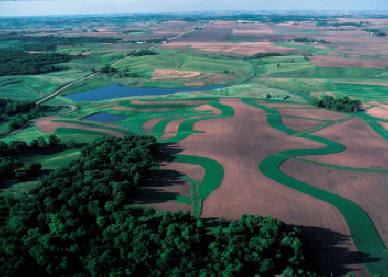
B.Habitat Fragmentation
1)small fragments are different
impacts on species found in
fragments
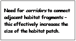
role of habitat
corridors
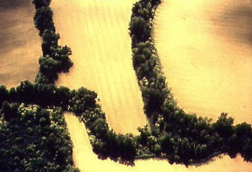
2)edge effects
changes in physical
conditions
changes in predation,
etc.
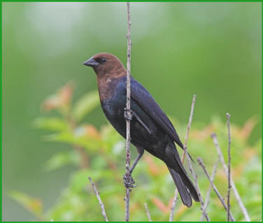
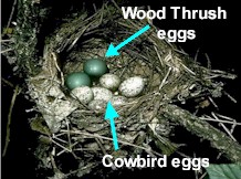
Brown-headed Cowbird
Brown headed
cowbirds are brood parasites, meaning the female lays her eggs in the nest of
other species.
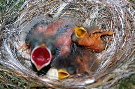
FEED ME! FEED ME! This Eastern phoebe nest has a parasitic
intruder. The larger, redder gape belongs to the older parasitic brown-headed
cowbird chick, while the smaller, paler gapes are the phoebe's own young.
(Mark Hauber/UC Berkeley)
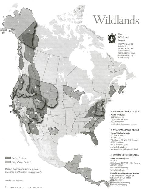
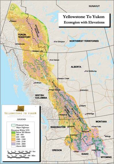
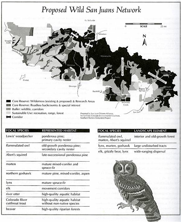
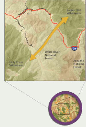
How can we
counteract the impacts of fragmentation? Examples from the Wildland institute’s
“Yukon to Yellowstone” (& beyond) project – creating/preserving corridors
between habitat fragments (Dave Foreman)
http://current.com/items/76791812/the_wildlands_project.htm - link (now gone -
2013) to video
about The Wildland Project's goal of connecting large areas of wildlife habitat